Wednesday, December 29, 2010

Rainforests of Northern NSW

NW view from MT Warning

For the past week we have been visiting the World Heritage sub tropical rain forests of Northern NSW  and Lamington national park east of the Gold Coast.
Our first stop was Mt Warning and then to Natural Arch.


Natural Arch

 From Natural Arch we drove to the superb Lamington national park. This park is situated 30km east of the Gold Coast, unfortunately the views to east are marred by sight of that vile place.


Coomera Falls
The walking is easy on well marked trails and once you walked more than 1km from the car we saw no one.


From Lamington we drove back south to NSW and ended up in the Toonumbar national park. This park is World Heritage listed and has a large stance of  Red Cedars .


Red Cedar


Tuesday, December 21, 2010

Mooloolaba to Yamba 15/12/2010

We spent two days in  Mooloolaba in torrential rain. The Mooloola river was a fecal brown and the beaches were not much better.  We decided to adventure into the heart of Sunshine Coast, the Pacific Fair shopping centre. A terrifying place, people everywhere, like ants attacking a carcase. We escaped back to the boat and made plans to depart for a quieter location. 

Our options were, to go to Surfers Paradise  on the outside of Morton/Stradbroke Islamds, or to sail to Brisbane then motor on the inside of these Islands. On the way up we had a few bumps getting past Jacobs Well so we elected to sail the outside.

The weather report was for light North East to North West winds and a chance of thunder storm but the next day, there was predicted thunderstorms for the Brisbane region.

We left in blue skies and light winds and made rapid progress south, passing Morton Island and North Stradbroke Island thanks to the (3 knot) east Australian current.
But.... to the South West the skies were getting dark....


We  altered course to get further out to sea as the storms appeared to be tracking towards the Brisbane area.


On the radio we heard that the Logan area got hit with hail and damaging winds. If we went on the inside of Morton Island we would have been hit with hail.

We are now well out to sea in light winds and 4.5knts of current watching the sun set over the high- rises of Surfers Paradise. The storms had passed and with only 90 Nm to go to Yamba and more storms predicted the next day, and not wanting to get stuck at Surfers, we elected to keep on going over night.

With not much wind,  we pulled the sails down and motored all the way to Yamba, arriving at 9am Thursday. Storms arrived a few hours later...


Lady Musgrave to Mooloolaba 10/12/2010

Lady Musgrave to Mooloolaba


With a north easterly wind blowing we weighed anchor from the delightful Lady Musgrave Island. We had to make a decision whether to go via Bunderburg and the inside of Fraser Island through the Great Sandy Straits and then Wide Bay Bar. Wide Bay Bar must be crossed at high tide and in good conditions and has claimed many boats.

The outside route is longer but there are no tidal considerations and hence will be shorter in time, not having to wait for high tide in a number of locations.

With the north easterly winds blowing, we elected to go on the outside of Fraser Island to Mooloolaba, 156 Nm away. We expected to arrive late  Saturday night.
The east Australian current  is a bonus this time heading south and at times we were doing 9 knts with 12 knts of breeze. We sailed to the edge of the continental shelf to maximize our speed. We arrived at Mooloolaba at 14:30 Saturday.

East Coast Current
 

Friday, December 17, 2010

Lady Musgrave Island 8/12/2010

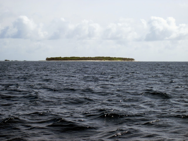
Lady Musgrave Island is a small coral cay with a surrounding lagoon that can be entered via a very narrow passage.


Entrance to the Lady Musgrave lagoon


The stay at Lady Musgrave was one of the highlights of the trip. The island is the second last island in the Great Barrier Reef, Lady Elliot is the last island and is just north of Fraser Island.

Lady Musgrave's lagoon is a great anchorage in moderate conditions not rolly and one faces into the prevailing wind, but if the weather turned nasty it would be an ugly place to be.

The water in the lagoon is crystal clear with plenty of sea and bird life.


Common Noddy


Turtle "Tractor Tracks" to their nest

Walking around the island takes about 1/2 an hour. The Mutton birds dig their burrows for nesting so one has to tread carefully.


The snorkeling and diving is fantastic in the lagoon


The diversity of the sea life is amazing and one feels like they are swimming in a aquarium.


Black Tipped reef shark


In the shallows of the lagoon we saw a school of black tipped reef sharks, while they may look impressive they were only 30cm long


We woke up on Friday morning and there was a North Easterly starting to blow. Finally the wind is blowing from the right direction !! So with much regret we decided to weigh anchor and depart, we could have stayed for another week but North Easterly winds seem to be a rare phenomenon this trip.

Monday, December 13, 2010

North West Island 5/12/2010

After all the rain at we had at Port Clinton we finally got a break in the weather and headed for Roslyn Bay marina just south of Yeppoon.
After spending a day restocking the boat we headed for North West Island.  The island is a coral cay 50 Nm from Roslyn bay and with light winds and clear sky's we motored the whole distance.
Our high tech fishing equipment was successful yet again with a very nice Spanish Mackerel that has provided us with 5 meals so far. Our set up is 40m of venetian blind cord, 10m of shock cord, a wire trace and a well used lure. This system requires no skill.


This time of year is the breading season for turtles and sea birds. Every night the
turtles come a shore to lay their eggs.

The first nights anchorage was rolly so we relocated to the south western side of the island in 10m of water and it was comfortable in the light conditions we where experiencing, but it would have been very uncomfortable if the wind got up.

 The island was used as a turtle cannery and there are some remnants of its past.

Friday, December 3, 2010

Port Clinton 2/12/2010

The weather forecast for the next few days is worsening so we decided to leave Hunter island and go to Yeppoon 60Nm to the south east before it gets bad. We left in blustery conditions and headed towards Thirsty Sound.

Thirsty Sound has the largest tides on the east coast of Australia so there are strong currents in the area, and it makes the seas choppy when it is windy. With the winds blowing from the south east we bashed our way towards Cape Townsand 20 Nm to the south east of Hunter island.


We got a solid bite on the line, hoping for a nice Spotted Mackerel we battled to get the fish in and to our surprise it was a baby black tipped reef shark!  Out came the bolt cutters to send it back to bite another day.


Micro Jaws

Our original plan was to stay the night at Cape Townsend and head to Yeppoon the next day. The winds started to increase through the day and the seas became rough so the anchorage at Cape Townsend was out. Our options either go all the way to Yeppoon or to Island Head or Port Clinton.

We got to Island Head at night fall after battling a 3knt current against us, the winds gusting to 30knts and the entrance to Island Head needs good visibility as there are shifting sand bars and so one can not rely on the charts. 
So we elected to keep going to Port Clinton 12Nm south of Island Head. We needed to get to the entrance of Port Clinton near to high tide that was at 7pm as there is a 3m bar to cross near the entrance. The current that we where battling started to abate as it got closer to high tide, the bulk of the tidal flow drains into Thirsty sound from the Whitsundays to the Keppel Islands so there is a lot of water flow in this area. 

We got to the entrance at 7:30 pitch black with wind squalls to 30knts and lots of rain. So relying on the GPS and depth sounder we made it in to Port Clinton. With no visibility made it a very tense situation. We would have been up the shit creek if the Yanks turned it off !

It got really ugly through the night, torrential rain and 35knt gusts. We made the right choice, Port Clinton is a excellent all weather anchorage.


A trough is forming off the coast and there wide spread flooding. A safe anchorage is a welcome relief.


Synoptic Situation
A slow moving high [1027hPa] lies over the southern Tasman Sea and extends a
ridge into the southern Coral Sea. The high is expected to weaken over the next
few days. A trough is expected to push off the Capricorn coast on Saturday and
deepen with a possible low forming offshore north of Fraser Island. Forecasts
for the weekend are highly dependent on the development and movement of this
trough/low.

IDQ1127001

UPDATED 
Capricornia Waters, St Lawrence to Burnett Heads:
A strong wind warning has been issued for south of Yeppoon for tonight.
Friday until midnight:  Wind: SE/NE 20/25 knots, increasing to 25/33 knots south
of Yeppoon late tonight. Seas: 2.2 metres, rising to 3.5 metres south of Yeppoon
late tonight. Swell: SE/NE 2 to 3 metres developing. Scattered showers and
isolated thunderstorms, increasing to thundery rain areas during the day.
Saturday:  Wind: SE/NE 25/33 knots south of Yeppoon. Mostly SW/NW winds 15/20
knots elsewhere, possibly tending S/SE 15/20 knots during the afternoon and
reaching 20/25 knots in the evening. Seas: 1.7 to 2.2 metre in open waters,
increasing to 3.5 metres south of Yeppoon. Swell: SE/NE 2 to 3 metres. Rain
areas and isolated thunderstorms.
Sunday:  Wind: SE/NE 15/20 knots south of Yeppoon, reaching 20/25 knots during
the morning. S/SE winds 15/20 knots elsewhere.


Trough forming off the Capricorn coast


Hunter island 1/12/2010


After two very rolly nights at Scawfell and Middle Percy island we decided to go to Hunter Island which is part of the Duke island chain.


 The anchorage is excellent and is sheltered from NE to SE winds and there was no swell getting in.

It is difficult to believe that we are in the tropics. The island feels like Tasmania, we have been having lots of rain and it is cool for this time of year

The Duke islands were once a Cattle and Deer farm, venison on the menu,mmm !

Maintenance

One of the joys of owning a boat is the continuous maintenance required to keep the thing afloat. Our boat is 15 years old and the rudder bearing is wearing out and needed replacement. When we first bought the boat there was a slight play in the rudder and after the long passage to the Lousiades the play had become worse. As we needed to get the boat anti fouled we decided to get the rudder bearing replaced at the same time.

It is good to know that the rudder was never going to fail. It is solidly built and took a lot of effort to get it back in place.

The steering is now much lighter and responsive. It will make "Pukey " the auto pilot job much easier.

Saturday, November 13, 2010

HIGH AND DRY!!

Hi All.

Sorry it's been a long time since we've updated our Blog.

One month has gone by since our return crossing of the Coral Sea back to Cairns.

The trip back into Australian waters was longer  than the 'dream run' we had going to PNG.
During this return trip we encounted every type of wind and sea condition you could think of, (barring the heights of the southern ocean seas!).

It's amazing how the Coral Sea differs from the Tasman Sea, which differs from the Pacific Ocean!
 In 3 words, I would describe the Coral Sea's sea-state as: Short, Sharp and Lumpy!

Not a smooth ride, but rather a jarring or 'bashing'  (into a headwind) experience!


Arriving into Cairns with salt encrusted, sleep deprived, wind-blown bodies was a welcoming but mixed experience.

Welcoming....the familiar feeling of a fresh water shower; a cappacino; and the ease of obtaining  fresh food/vegies;

Mixed....my mind was still back with the Louisiades indigenous people and the daily  island life.


Compared with some tribes of mainland PNG, The Louisiade people are built of slighter  frame. We found them extremely gentle, shy, but welcoming.


The surrounding sea is their home. They own the islands they live on, including the surrounding waters enclosed by the reef.


So if one wants to fish or collect crayfish, it's polite to ask their permission, or even better, to invite them along (as they are faster and more skilled in catching whatever you want)! Then in exchange we would trade a T-shirt or fish hooks.
Money is not as valued, as there are no shops!


....Anyway back to present day happenings in Queensland waters.
"Out There",Greg and I are High and Dry... getting some repair work done to the Rigging ; along with general repair  to keel, rudder, and water blasting of hull, anti-fouling etc.

During the leg from Magnetic Island to Cape Upstart  and Gloucester Passage, we hit 'washing machine' conditions....or as Kirsty Brown would say: "Ripping + Curling" (esp off Cape Bowling Green where there's lots of shallow banks).

 Strong squally winds and steep (short wave-length) seas hitting us at the wrong angle, was the straw that broke the camel's back. This was when Greg saw one of the starboard shrouds starting to come apart.
 We quickly dropped all sails, so as not to overload the rigging (as this is what keeps the mast vertical); then started motoring to the nearest port which has riggers available.

Fortunately, Airlie Beach Slipway had an immediate vacancy. So to our surprise, we motored into the Marina straight towards the "travel Lift", where two shipwrights were standing with ropes in hand directing us onto the lifting straps.

So here we are High and Dry with first floor ocean views with live-a-board permission.!
Don't you love Queensland's insurance and OH+S standards?