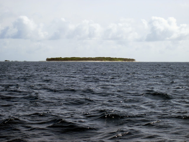
The weather forecast for the next few days is worsening so we decided to leave Hunter island and go to Yeppoon 60Nm to the south east before it gets bad. We left in blustery conditions and headed towards Thirsty Sound.
Thirsty Sound has the largest tides on the east coast of Australia so there are strong currents in the area, and it makes the seas choppy when it is windy. With the winds blowing from the south east we bashed our way towards Cape Townsand 20 Nm to the south east of Hunter island.
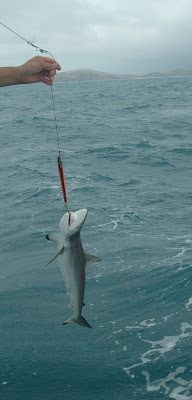
We got a solid bite on the line, hoping for a nice Spotted Mackerel we battled to get the fish in and to our surprise it was a baby black tipped reef shark! Out came the bolt cutters to send it back to bite another day.
 |
| Micro Jaws |
Our original plan was to stay the night at Cape Townsend and head to Yeppoon the next day. The winds started to increase through the day and the seas became rough so the anchorage at Cape Townsend was out. Our options either go all the way to Yeppoon or to Island Head or Port Clinton.
We got to Island Head at night fall after battling a 3knt current against us, the winds gusting to 30knts and the entrance to Island Head needs good visibility as there are shifting sand bars and so one can not rely on the charts.
So we elected to keep going to Port Clinton 12Nm south of Island Head. We needed to get to the entrance of Port Clinton near to high tide that was at 7pm as there is a 3m bar to cross near the entrance. The current that we where battling started to abate as it got closer to high tide, the bulk of the tidal flow drains into Thirsty sound from the Whitsundays to the Keppel Islands so there is a lot of water flow in this area.
We got to the entrance at 7:30 pitch black with wind squalls to 30knts and lots of rain. So relying on the GPS and depth sounder we made it in to Port Clinton. With no visibility made it a very tense situation. We would have been up the shit creek if the Yanks turned it off !
It got really ugly through the night, torrential rain and 35knt gusts. We made the right choice, Port Clinton is a excellent all weather anchorage.
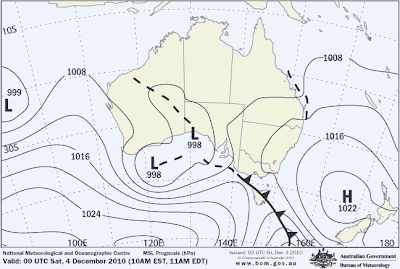
A trough is forming off the coast and there wide spread flooding. A safe anchorage is a welcome relief.
Synoptic Situation
A slow moving high [1027hPa] lies over the southern Tasman Sea and extends a
ridge into the southern Coral Sea. The high is expected to weaken over the next
few days. A trough is expected to push off the Capricorn coast on Saturday and
deepen with a possible low forming offshore north of Fraser Island. Forecasts
for the weekend are highly dependent on the development and movement of this
trough/low.

IDQ1127001

UPDATED
Capricornia Waters, St Lawrence to Burnett Heads:
A strong wind warning has been issued for south of Yeppoon for tonight.
Friday until midnight:  Wind: SE/NE 20/25 knots, increasing to 25/33 knots south
of Yeppoon late tonight. Seas: 2.2 metres, rising to 3.5 metres south of Yeppoon
late tonight. Swell: SE/NE 2 to 3 metres developing. Scattered showers and
isolated thunderstorms, increasing to thundery rain areas during the day.
Saturday:  Wind: SE/NE 25/33 knots south of Yeppoon. Mostly SW/NW winds 15/20
knots elsewhere, possibly tending S/SE 15/20 knots during the afternoon and
reaching 20/25 knots in the evening. Seas: 1.7 to 2.2 metre in open waters,
increasing to 3.5 metres south of Yeppoon. Swell: SE/NE 2 to 3 metres. Rain
areas and isolated thunderstorms.
Sunday:  Wind: SE/NE 15/20 knots south of Yeppoon, reaching 20/25 knots during
the morning. S/SE winds 15/20 knots elsewhere.
 |
| Trough forming off the Capricorn coast |


